Table of Contents
5-1 Shoreline Processes
Read Chapter 17 in Physical Geology.
As described in the introduction to Chapter 17, we need to understand shoreline processes so that we can remain safe while visiting or living in coastal regions, and so that we can avoid making changes that could disturb coastal equilibrium.
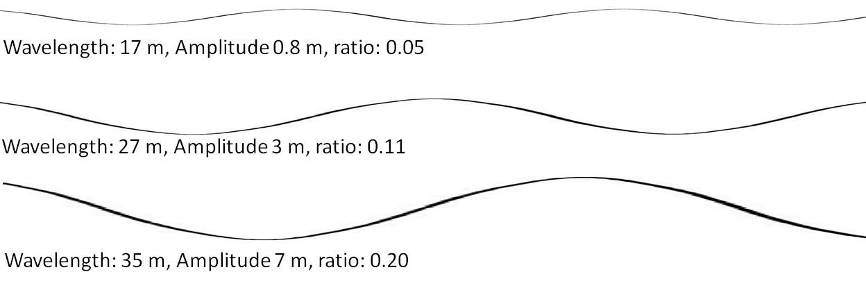
Section 17.1 discusses wind waves, the key driver of coastal processes. Read carefully through the material on wave parameters, and the various factors that determine the size of waves. One of the important features of ocean waves is that they tend to get steeper as they get bigger, which is shown in Figure 5-1, although the amplitudes are somewhat exaggerated to make the differences in the ratios more obvious.
Completing Exercise 17.1 will help with your understanding of the factors that are important for determining wave dimensions.
Figure 17.1.2 shows how the water beneath the surface moves in circular orbits as a wave passes over, and how this disturbance of the water column continues to a depth of one-half the wavelength.
Exercise: If you haven’t already viewed Kraaiennest’s (2008) animation of wave orbits, please do so now. This animation will really help you to understand this concept.
Figure 17.1.3 shows how this disturbed water interacts with the lake or ocean bed as the wave approaches shallow water, and how this interaction increases the height of the waves and produces breakers.
Most waves approach the shore at an angle. Figure 17.1.5 and 17.1.6 illustrate how this leads to wave refraction—making the waves nearly parallel to the shore. The fact that waves approach at an angle also generates a longshore current within the surf zone.
Exercise 17.2 is intended to help you to understand wave refraction and the generation of a longshore current.
A longshore current can move massive amounts of water along the shore and, in the process, can also push the sediment churned up by breaking waves. Sediment also is moved on the beach face itself by swash and backwash as waves wash up at an angle and then down vertically (Figure 17.1.8). Longshore currents, and swash and backwash, are the two processes that combine to create longshore drift—the slow and steady movement of sediment along the shore in the direction of the prevailing approach of waves.
The relentless push of waves up the beach can result in an accumulation of water on the beach face, some of which returns to the ocean via rip currents, as illustrated on Figures 17.1.9 and 17.1.10.
Tides are important to shoreline erosional and depositional processes, mostly because they expand the range of elevations over which wave energy hits the shore, thus making ocean coastal features—such as beaches—wider than they would be otherwise.
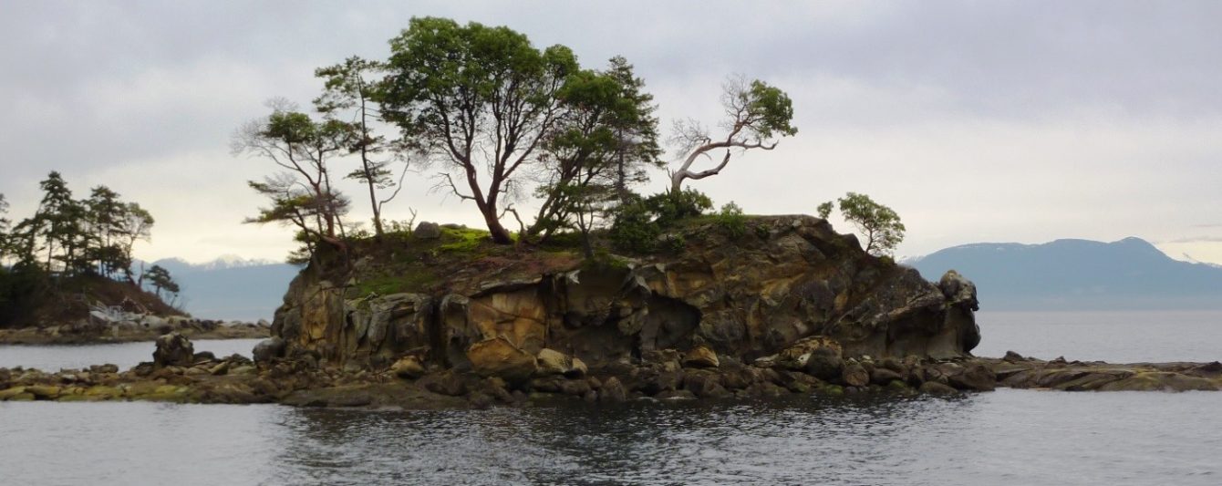
Wave erosion has a tremendous impact on coastal features, especially on open-ocean coasts where the waves can be large and virtually constant. As shown on Figure 17.2.1, wave refraction results in the energy being focussed on headlands, and this ultimately leads to coastal straightening (Figure 17.2.5). Some of the important features of coastal erosion, such as stacks, arches, caves, cliffs, and wave-cut platforms, are described in Section 17.2 of the text.
Exercise: Identify some of the coastal erosion features in Figure 5-2.
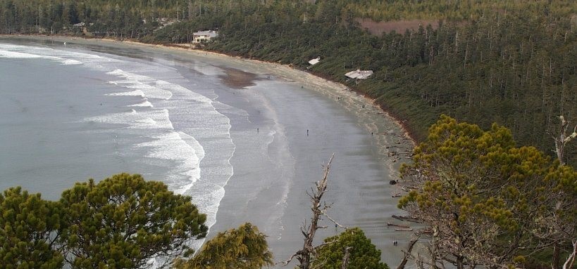
Depositional processes also are very important along coasts, especially to people who like to hang out on beaches. Figure 17.3.1 summarizes the components of a sandy marine beach. A beach can be divided into a backshore (above the high-tide level) and a foreshore (between low and high tide) (see Figure 5-3). If the shoreline is relatively flat, the beach face can be hundreds of metres wide at low tide. Other important features of a beach are in the near off-shore area, and include a trough and a longshore bar. As shown in Figure 17.3.2, the shape of a beach changes depending on the size of the waves coming in. During rough seasons (e.g., during the winter on Canada’s west coast) the beach becomes depleted, and some of that sand is stored offshore in a larger than normal longshore bar.
Exercise: Identify the backshore, foreshore, and surf zone in Figure 5-3.
Longshore drift contributes to the formation of a range of different coastal depositional features, including spits, bay-mouth bars, tombolos, and barrier islands. Please read about these in the textbook.
Completing Exercise 17.3 will help you to understand the processes that cause the formation of coastal depositional features.
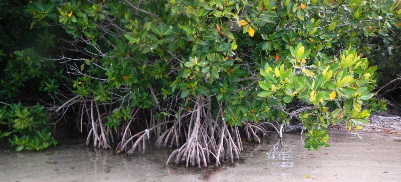
Marine life is particularly abundant along tropical coasts, and in areas with relatively shallow, warm, and clear water (not clouded by river sediment, for example), organisms such as corals, sponges, urchins, coralline algae, and many others build reefs and produce an abundant supply of calcareous sediment that forms white-sand beaches. Numerous other organisms are important on tropical shores, including many types of green algae (Figure 6.2.1) and mangroves
(Figure 5-4).
Section 17.4 includes a discussion about the impacts of sea-level change. In unglaciated parts of the world, sea level rose by about 125 m during the last deglaciation (from 20,000 years ago to about 6,000 years ago). In areas that were strongly glaciated, like most of Canada, the amount of post-glacial sea-level rise has varied significantly because in these areas the crust was depressed to varying degrees by glacial ice. So, although the rise in sea level was the same everywhere, in some areas the post-glacial isostatic rebound equalled or exceeded the ice-melt (eustatic) rise, so an actual sea-level rise did not occur; instead, there was a relative sea-level drop. To make matters even more complicated, ice-melt (eustatic) sea-level rise is typically significantly faster than the isostatic crustal adjustments. For that reason, there are many locations around coastal BC where sea levels 12,000 years ago were significantly higher than they are now, because the sea-level rose relatively quickly (over a few thousand years) but have “dropped” again because crustal rebound eventually caught up.
Exercise 17.4 is intended to help you to understand the implications of post-glacial ice-melt (eustatic sea level rise) and isostatic crustal rebound.
All over the world, people and governments have tried to modify shoreline processes to suit their own purposes, often with little regard for other people’s needs, and virtually no regard for the effects on ecosystems. Section 17.5 describes some of these modifications and their implications.
To enhance your understanding of the effects of shoreline modifications, complete Exercise 17.5.